Digital Wayfinding – what real life can teach us
a
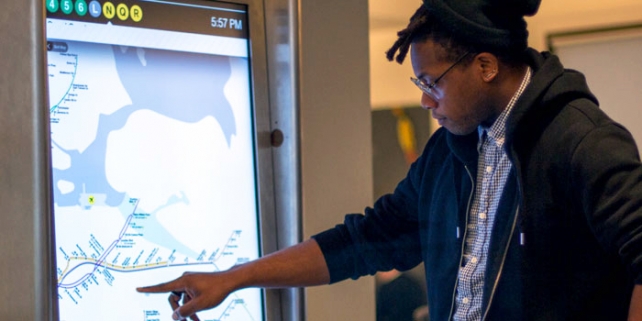
So I recently did a job where I had to engage with wayfinding theory. This is fascinating stuff: a highly specialised, well developed field that has traditionally called on elements of psychology, architecture and town planning. Interestingly though, there are a lot of times where the same (or similar) problems exist in our virtual world – we ‘navigate’ systems arguably more often than we do streets nowdays. Thus there is a whole field here ripe for picking up and pointing in a new direction – and which (in the short time I spent researching and working with it) offered me some pretty amazing insights into how we get around our environments – both real and virtual.
But it’s complicated.
 Firstly – there is an enormous variation in how people actually do navigate. Different people might navigate the same environment in quite different ways. Some people will have a complete ‘mental model’ of the scene in which they update their position as they travel, whilst other people will simply have a sequence of instructions: “At the shoe-shop, turn left. When you see the park, cross the road.” etc… Furthermore the same person might use quite different approaches depending on the terrain (affordances) and also depending on circumstance (experience, cognitive load, etc..). And yes, there seem to be sex differences in both abilities in some domains and also strategies chosen. It would seem though, that all of these approaches do resemble a ‘means-end analysis’ style of process – I guess by definition really – you are after all ‘finding’ your ‘way’.
 These kind of insights, of course, have beautiful parallels in system navigation. How do you find a file on your system? Do you go to the application that created it and look in the ‘recent items’ menu? Or do you open a file system browser and then look in the particular area that you think the file is likely have been saved? Which one is more efficient? Which one is easier when your thinking about something else? How can we make this process easier?
One common element to almost all wayfinding approaches is landmarks. These occupy a central role in wayfinding thinking. And when we start looking at these, landmarks suddenly get really interesting. They can offer a number of facilities. Again – not everyone will use them in the same way, and the same way every time. But typically landmarks can offer the following attributes:
- They allow you to distinguish between different locales.
- They allow you to orient yourself in relation to either local or global features.
- They allow you to orient yourself within a mental model of the terrain.
- They can show you your proximity to a goal – or position in a sequence of landmarks.
- They can direct you to the next landmark or a subgoal.
- They can represent decision points for route planning.
a
Which is cool. So when you’re visually searching for a given file and all of a sudden your eyes float across a folder-name such as ‘2012 projects’ and you go ‘Ahah! This is where I should look in’ what is actually happening is that the folder name is identifying a particular set of objects (local), allows you to orientate yourself (‘I now need to look WITHIN this folder’) and is giving you some indication of proximity (‘I will now need to find the project folder, then the ‘images’ folder within – so what I’m looking for will be two levels down‘).

(line)
On the other hand – some people might not be treat the proximity information differently and not be using a spatial model at all. Rather than use the little arrows to expose more and more of the folder structure, they might simply know ‘ahah – now I have to double click on this’ – thereby entering the folder and relinquishing the spatially orientated display in favour of the clicked folder contents taking up the whole screen.
So then really – seeing how landmarks are so important for navigation – the question becomes how can we make them more effective/useful. Which first requires examining what people select naturally as landmarks.
 Now there are a LOT of theories about what constitutes a good landmark. But the most parsimonious version that I came across was simply that landmarks are selected on the basis of Salience. The most salient feature in an environment is the most readily remembered and recognized. Fair enough really.
And what is nice about this definition is that it becomes a proposition that is relative to the environment. Proposing a given set of guidelines for navigation tools becomes problematic. What is distinctive in one environment may not be in another. ‘Turn left at the big building’ is unlikely to be much help in a big city, but work great on a farm, whereas ‘Turn left at the big rock’ may be useless on a farm but work really well in a built envirionment. Salience is context sensitive.
![]() So one of the best things we can do to enable system navigation is provide good landmarks. So coloured gradients behind lists to emphasise their position in relation to one another. Visually distinctive local environments. Allow users to colour code and customize their environment (file names, icons, folders) or make icons visually distinct by providing a preview of what’s inside.
So one of the best things we can do to enable system navigation is provide good landmarks. So coloured gradients behind lists to emphasise their position in relation to one another. Visually distinctive local environments. Allow users to colour code and customize their environment (file names, icons, folders) or make icons visually distinct by providing a preview of what’s inside.
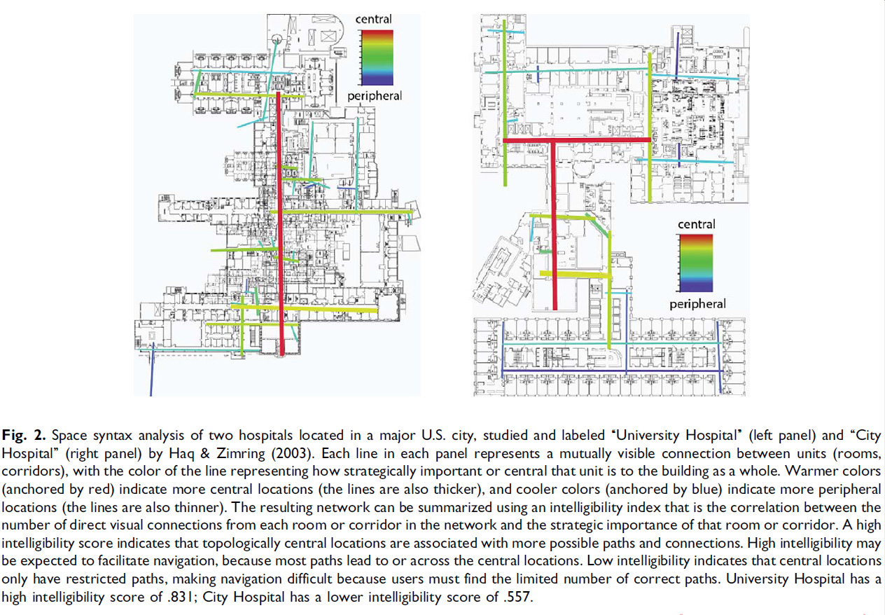
Furthermore, there has been lots of research into what makes for good and bad environments. Some buildings are notorious for being difficult to navigate, and I think we can all recall a system or application that seemed to always be confusing to get around in. There are a few things that people have found are common to environments that are really good to navigate.
- Self-Similarity of features. Ie: resemblance of local and global features.
- Visual access between key locations.
- Lower environmental complexity.
(line)
Each of these is worthy of considerable discussion, but I find the Visual Access aspect really interesting. Aparently a good tool for navigation is being able to see from one location to another. Ie: seeing only a tiny section of a map at a time is less useful than being able to see the whole thing. Alternatively being able to look out from the point you are now and see your goal – or other landmarks in the environment – also makes things much easier to navigate.
Unfortunately, it would seem that a lot of interfaces seem to be leaning away from this approach and trying to remove or downplay this kind of information. Contemporary design, with its emphasis on minimalism – seems to specifically strip away these kind of relationships.
 It is also interesting to note the unfortunate byproducts of the lack of application common storage on mobile platforms. Otherwise being sold to us as: “app-centric content experiences“. Siloing information like this means that we need to store more information in our memories about where a file is. We now need to store which application created it as well as information about the file itself. Furthermore, since many applications use an identical file navigation system (the bookshelf interface) – landmarks become less useful since they are no longer unique. “The file was up in the top right hand corner – but was it in pages, notes, or on my google-drive? Hmmm…”
 The final thing I want to mention here is a finding about how our mental models correspond to reality. As mentioned we don’t always use an actual mental model, but when we do – they can be incredibly data rich and effective tools for navigation. These mental models have an uneasy relationship with reality though. They can be represented by things such as:
- A Map (some people can actually ‘see’ it).
- A network – consisting of nodes and paths, but less (or less accurate) information about distance.
- A catalog of routes – each of which is more or less independent of each other.
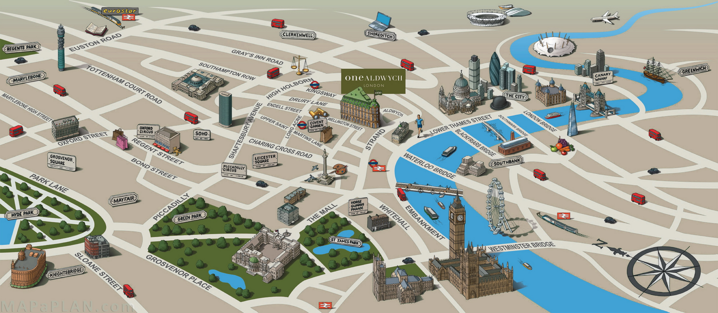
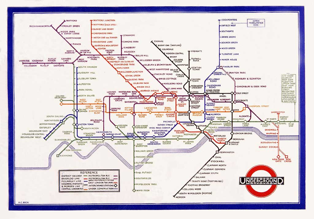
Furthermore – research has revealed some really interesting properties of our mental models. We seem to be quite good at recognizing and then recalling spatial relationships between nodes (or landmarks): things such as ‘Behind the shopping centre’, or ‘Underneath the blue icon’. But on the other hand we are quite bad at distance. Ie: the most common distortion of our mental models is metricality. So we’re not very good at remembering exactly how FAR underneath the blue icon our target is. Which explains beautifully why we are so happy to use very abstract representations of terrain, such as the famous London subway map, where distance is thrown away in favour of emphasizing the sequential arrangement of nodes. Fascinating.
References
Bidwell, N. J., Lueg, C., & Axup, J. (2005). The territory is the map: designing navigational aids. Paper presented at the Proceedings of the 6th ACM SIGCHI New Zealand chapter’s international conference on Computer-human interaction: making CHI natural.
Carlson, L. A., Hölscher, C., Shipley, T. F., & Dalton, R. C. (2010). Getting Lost in Buildings. Current Directions in Psychological Science, 19(5), 284-289.
Elvins, T. T. (1997). VisFiles: virtually lost in virtual worlds – wayfinding without a cognitive map. ACM SIGGRAPH Computer Graphics, 31(3), 15-17.
Freksa, C., Mark, D., Sorrows, M., & Hirtle, S. (1999). The Nature of Landmarks for Real and Electronic Spaces. Spatial Information Theory. Cognitive and Computational Foundations of Geographic Information Science (Vol. 1661, pp. 37-50): Springer Berlin Heidelberg.
Hölscher, C., Montello, D. R., & Schnitzler, V. (2013). Wayfinding Cognition & Mobile Maps for Indoor Settings.
Kato, Y., & Takeuchi, Y. (2003). Individual differences in wayfinding strategies. Journal of Environmental Psychology, 23(2), 171-188. Kuipers, B. (1978). Modeling spatial knowledge. Cognitive Science, 2(2), 129-153.
Nothegger, C., Winter, S., & Raubal, M. (2004). Selection of Salient Features for Route Directions. Spatial Cognition & Computation, 4(2), 113-136.
Spiers, H. J., & Maguire, E. A. (2008). The dynamic nature of cognition during wayfinding. Journal of Environmental Psychology, 28(3), 232-249.
Vinson, N. G. (1999). Design guidelines for landmarks to support navigation in virtual environments. Paper presented at the Proceedings of the SIGCHI conference on Human Factors in Computing Systems.
Wiener, J. M., Büchner, S. J., & Hölscher, C. (2009). Taxonomy of human wayfinding tasks: A knowledge-based approach. Spatial Cognition & Computation, 9(2), 152-165.
 Address: 11 Silva St, Tamarama, Sydney, Australia
 Phone: +61 2 (0) 404 214 889
 Email: